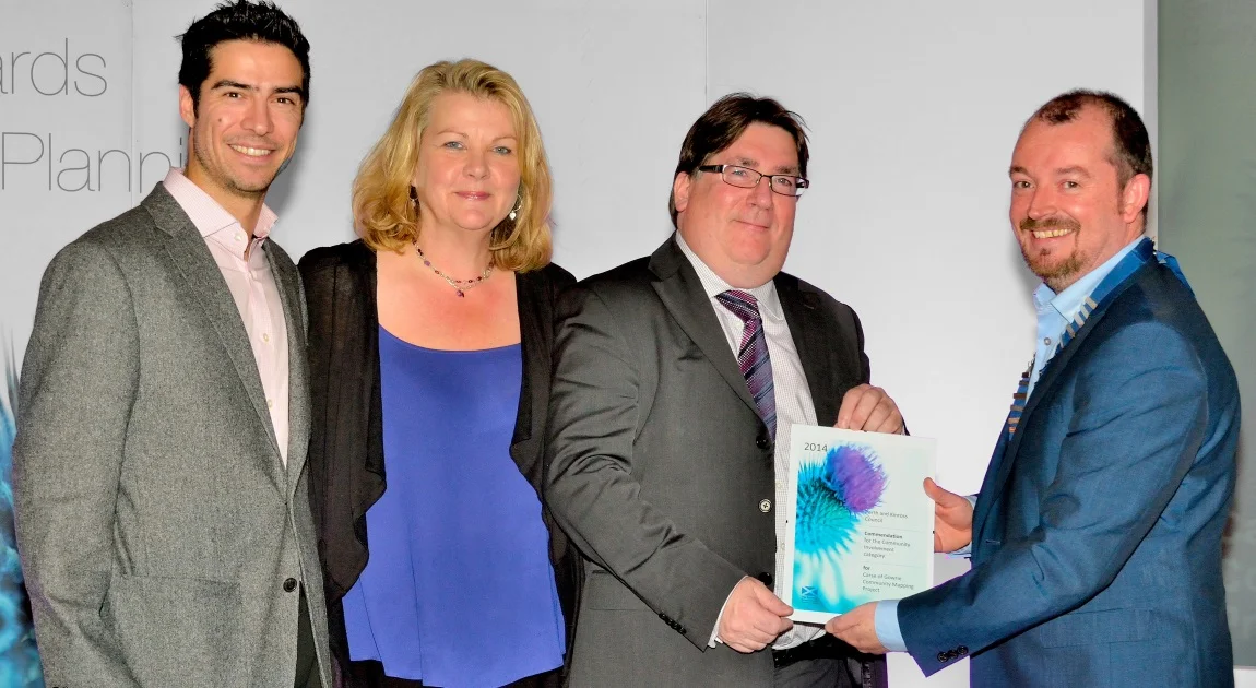
After European recognition at the Climate Change Adaptation Conference in Hamburg earlier this year, our trail blazing approach to community mapping has been awarded a Commendation at the Scottish Government Quality for Planning Awards 2014 in Edinburgh!
Energy Archipelago Beta Site Released
In partnership with Scene Consulting, the James Hutton Institute and Community Power Agency (Australia), GeoGeo has been leading the development of a global community energy portal, known as Energy Archipelago. The aim of this platform is to provide information about locally owned and managed renewable energy projects developed by citizen collectives near you.
GeoGeo gets Airborne!!
Is it a bird? Is it a plane? NOPE it's Amie, GeoGeo's latest unmanned aircraft system (UAS) and it's her mission to provide communities with 2D and 3D landscapes at a record-breaking 3cm accuracy. Our new airborne services will help bolster our existing community mapping efforts, helping local people have access to the latest aerial imagery and associated products.
Citizen science mapping pilots in Scotland!
Having been utilised for public health, conflict & community energy projects across East Africa, the GeoGeo's citizen science mapping framework was piloted in rural Scotland in early 2013. By introducing communities to the latest open source mapping tools, local citizens were able to create maps and datasets to help themselves (and government) plan and prepare for the local impacts of climate change...and a whole lot more.
In partnership with Perth & Kinross City Council, Adaptation Scotland, Sniffer, and the Carse of Gowrie Sustainability Group.